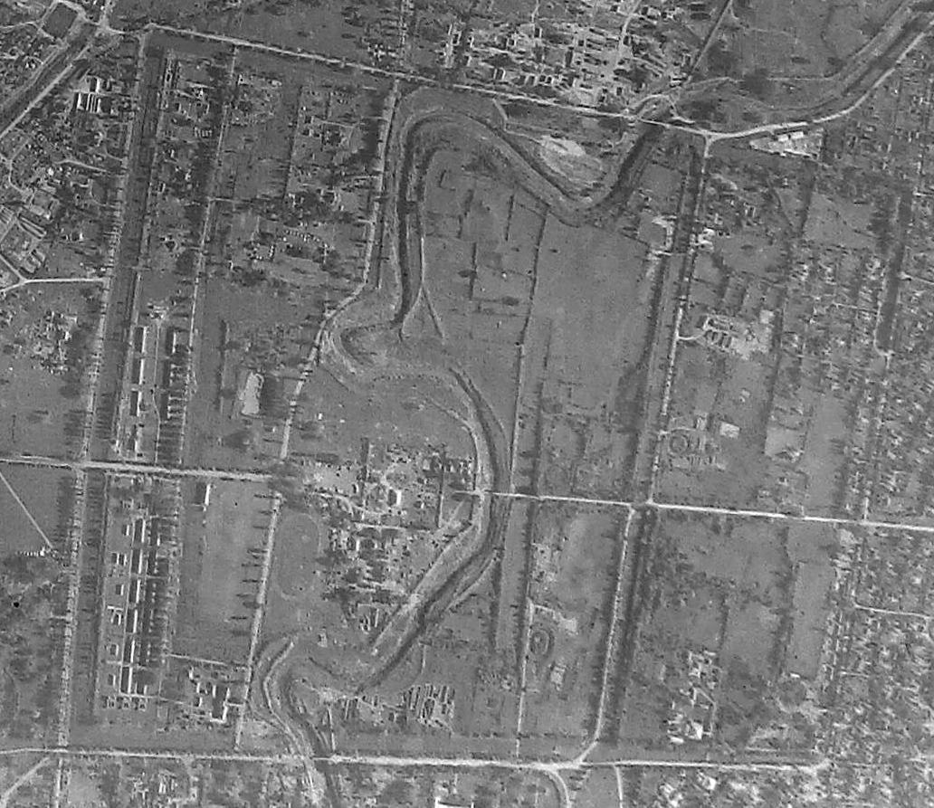
 Imphal, July 27 2017: A photograph taken by the Royal Air Force (RAF) of Great Britain shows a much larger Kangla .
The photograph taken by an American pilot attached to RAF during the Second World War on April 16, 1944 shows that the premises of Kangla extended up to Ayangpalli in the East.
As shown in the photograph, Imphal River flows through Kangla Fort and its moats extended to Ayangpalli.
It shows no other structure except the royal palace.
There was also a road from which extended from the western boundary to the eastern boundary and it passed over Imphal River.
But today, Imphal River serves as the eastern boundary of Kangla.
Beyond Imphal River, many Government and private buildings have been constructed.
The total area of Kangla is 237.62 acres when it was handed over to the State Government by Prime Minister Dr Manmohan Singh on November 20, 2004.
But its area has been slowly shrinking due to erosion by Imphal River.
Source: The Sangai Express


