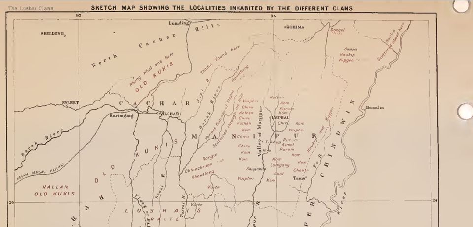
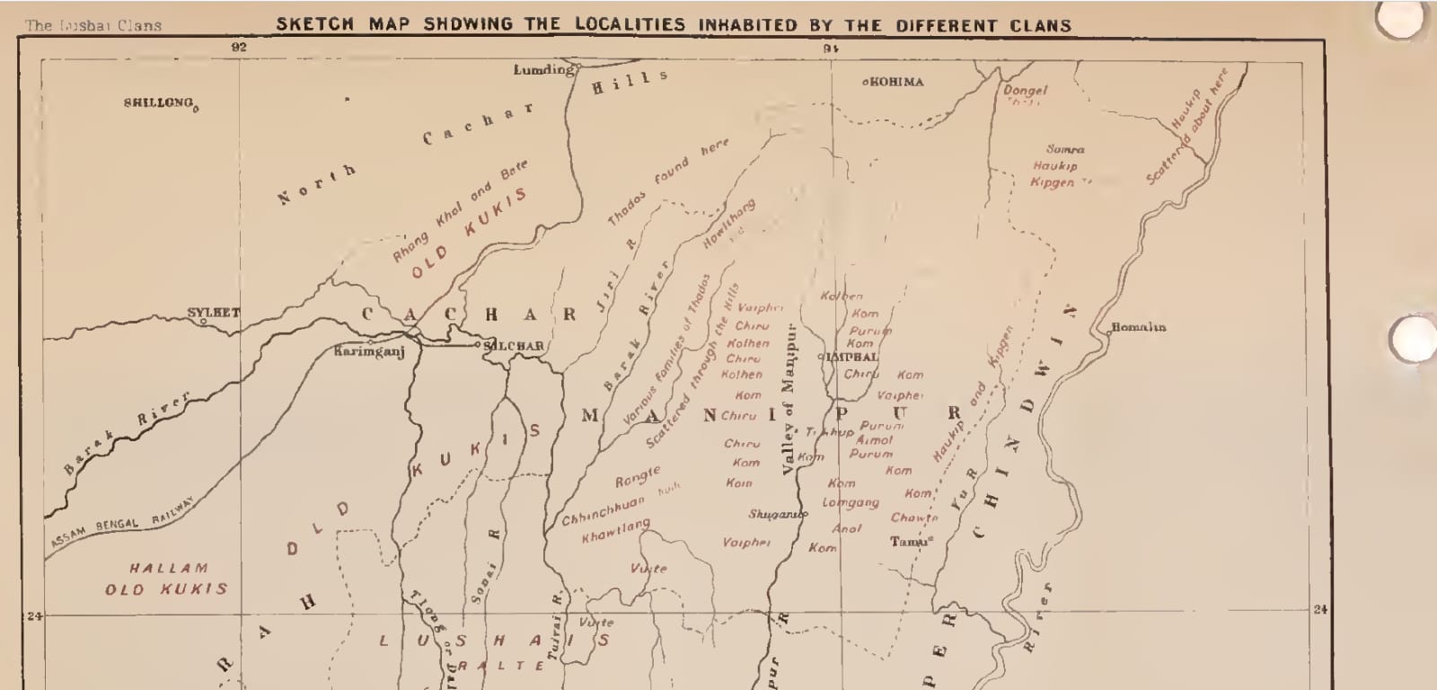
Sketch Map showing the localities inhabited by different clans - 1912 Last updated on Aug 27, 2023 Manipur Sketch Map - 1912 This British Map from 1912 shows the settlement areas of different Tribes in Manipur. Previous Centre instructs Manipur, Mizoram to record I&K Police biometrics of illegal migrants by September 2023 Next Counter to EGI report on Manipur