
Sketch Map showing the localities inhabited by different clans - 1912
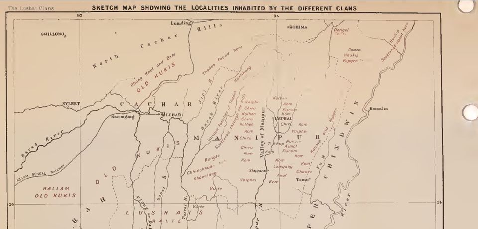
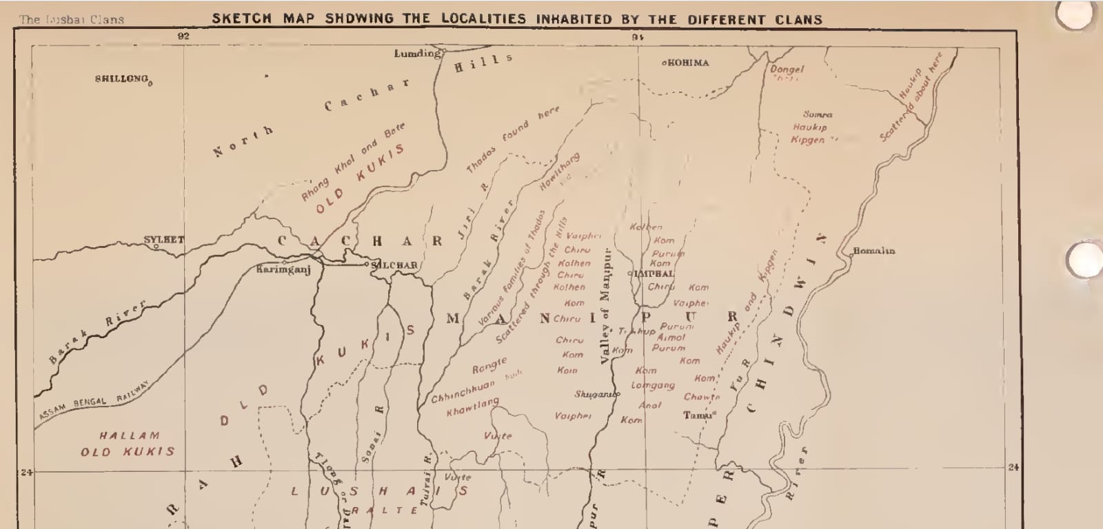
This British Map from 1912 shows the settlement areas of different Tribes in Manipur.
As an event approaches, it is worth considering how details related to photoshoot preparation will affect the complete look. With practical wear in mind, it is sensible to balance details related to cosplay costumes with care and storage needs. To compare practical details about details related to costume sizing, cosplay costumes for anime fans can help narrow the options for a specific purpose. Before the preparation is complete, it is useful to check details related to cosplay costume sets against the wearer's own needs.