 “Loss of an erstwhile Kingdom to a Hamlet with an antagonistic name…!”
The question “where is Manipur…?” looks to be funny and seems to be very easy to answer at sight. However, none of us could give the right answer as it is not so easy as it appears. At the end of this article, I’m sure that the learned reader(s) will lovely call and would love to change the name Manipur to Kangleipak. It will be surprising you to hear that Manipur is there in almost all the states of India. And there are five Manipurs in one district of a state, four Manipurs in one district of a state, fourteen Manipurs in one state and so on. In total, there are 67 Manipurs in India till date. The 67 Manipurs in India are located at the followings districts/states of India:
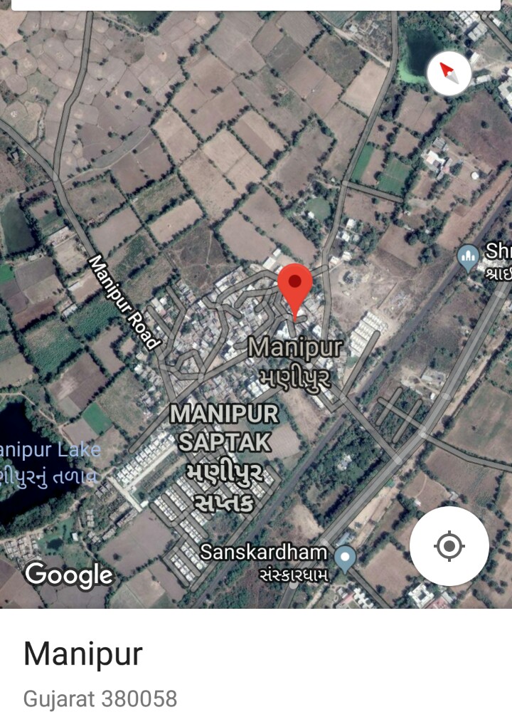
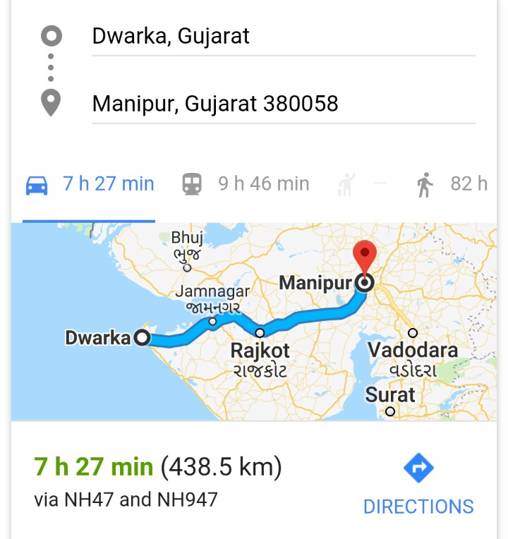
1. Manipur is in Ahmedabad district (Gujarat)
2. Manipur is in Mahesana district (Gujarat)
3. Manipur is in Panch Mahals district (Gujarat)
4. Manipur is in of Dungarpur district (Rajasthan)
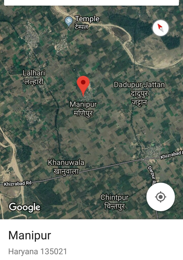
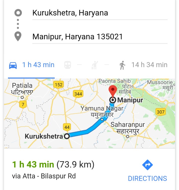
5. Manipur is in Yamuna Nagar district (Haryana)
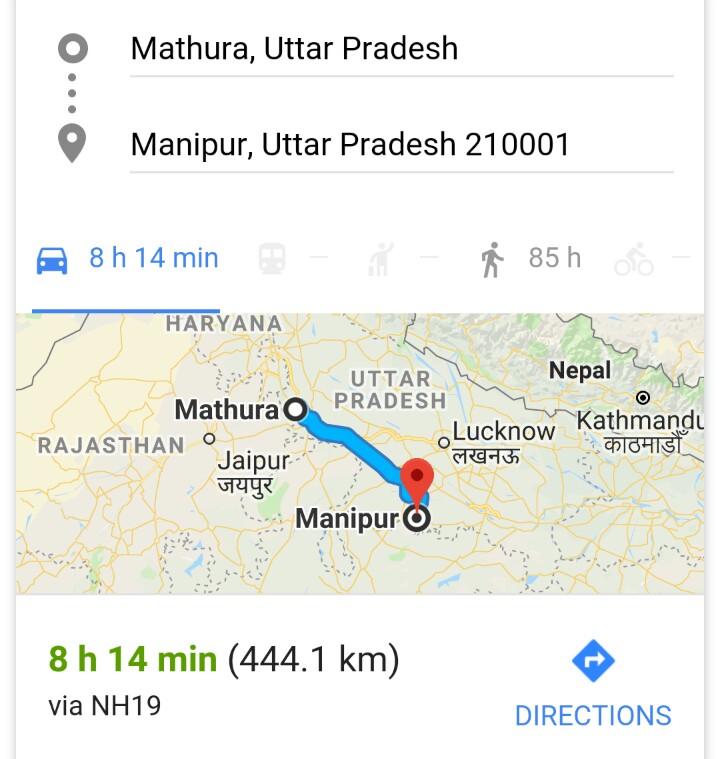
6. Manipur is in Banda district (Uttar Pradesh)
7. Manipur is in Fatehpur district (Uttar Pradesh)
8. Manipur is in Jaunpur district (Uttar Pradesh)
9. Manipur is in Allahabad district (Uttar Pradesh)
10. Manipur is in Sultanpur district (Uttar Pradesh)
11. Mannipur is in Gorakhpur district (Uttar Pradesh)
12. Manipur is in Aligarh district (Uttar Pradesh)
13. Manipur is in Hardoi district (Uttar Pradesh)
14. Manipur is in Pratapgarh district (Uttar Pradesh)
15. Manipur is in Kaushambi district (Uttar Pradesh)
16. Manipur is in Ballia district (Uttar Pradesh)
17. Manipur is in Ghazipur district (Uttar Pradesh)
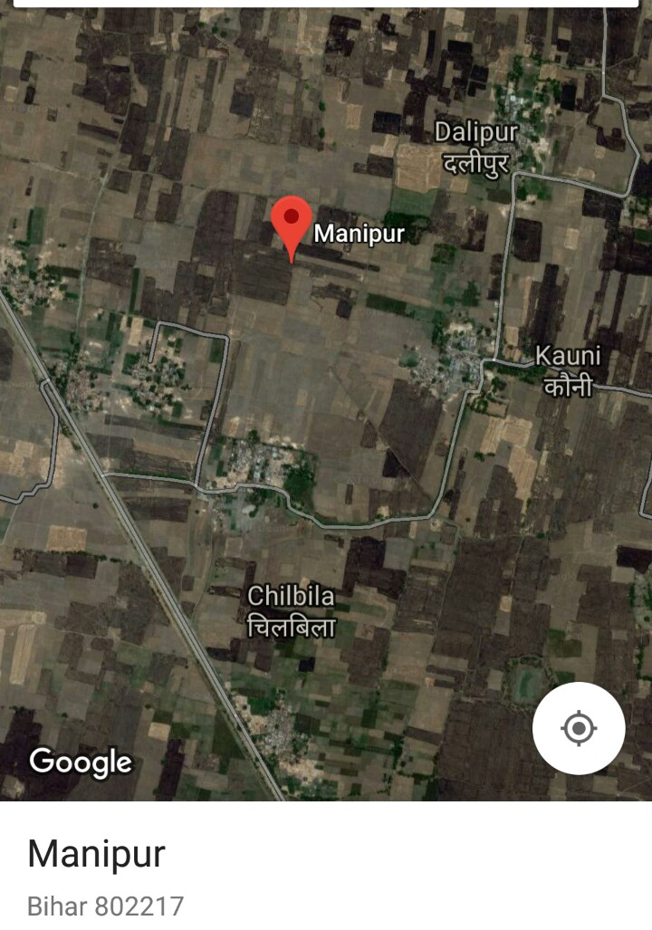
18. Manipur is in Muzaffarpur district (Bihar)
19. Manipur is in Samastipur district (Bihar)
20. Manipur is in Bhagalpur district (Bihar)
21. 2 Manipurs are in Buxar district (Bihar)
22. Manipur is in Kaimur district (Bihar)
23. 2 Manipurs are in Rohtas district (Bihar)
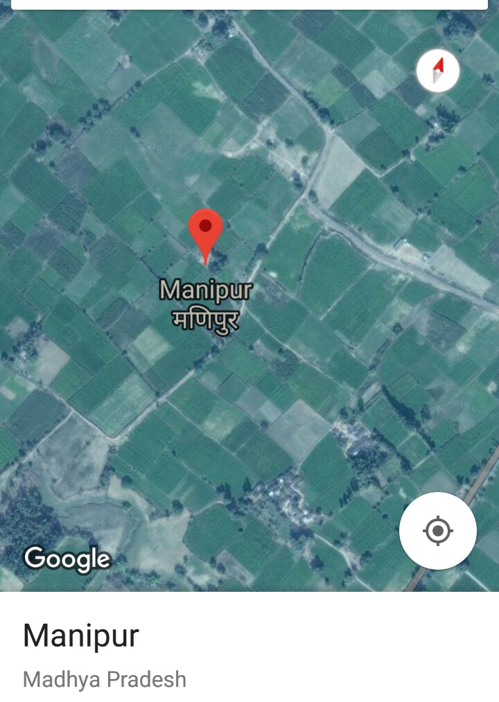
24. Manipur is in Panna district (Madhya Pradesh)
25. Manipur is in Rewa district (Madhya Pradesh)
26. Manipur is in Thane district (Maharashtra)
27. Manipur is in Dhenkanal district (Orissa)
28. Manipur (of Mahabharat) is in Kendrapara district (Orissa)
29. Manipur is in Baleswar district (Orissa)
30. Manipur is in Kendujhar district (Orissa)
31. 2 Manipurs are in Khordha district (Orissa)
32. Manipur is in Ganjam district (Orissa)
33. Manipur is in Nayagarh district (Orissa)
34. Manipur is in Jajapur district (Orissa)
35. Manipur is in Cuttuck district (Orissa)
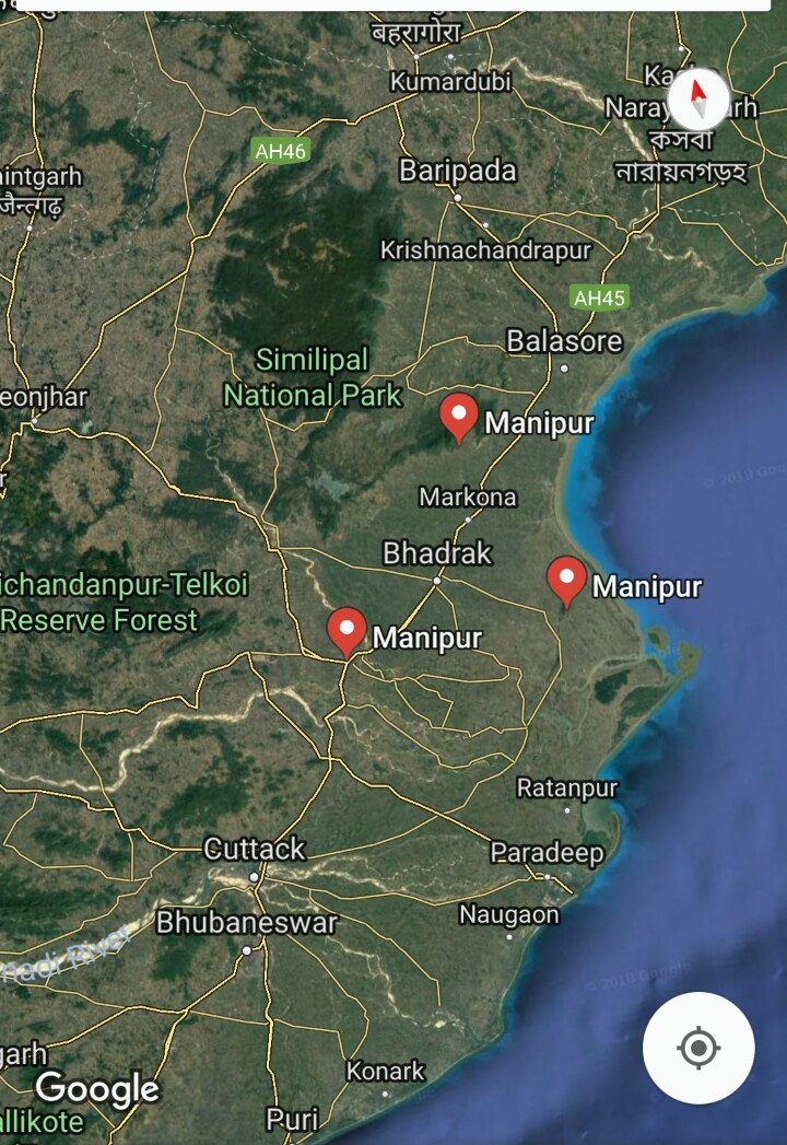
36. Manipur is in Bhadrak district (Orissa)
37. Manipur is in Bargarh district (Orissa)
38. Manipur is in Baudh district (Orissa)
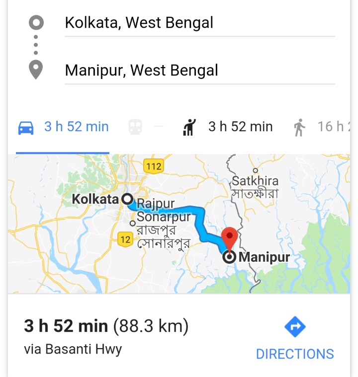
39. 5 Manipurs are in Bankura district (West Bengal)
40. 4 Manipurs are in Puruliya district (West Bengal)
41. 2 Manipurs are in Hugli district (West Bengal)
42. 2 Manipurs are in Dakshin Dinajpur district (West Bengal)
43. Manipur is in North Twenty Four Parganas district (West Bengal)
44. 3 Manipurs are in Marigoan district (Assam)
45. Manipurs is in Barpeta district (Assam)
46. Manipura is in Udupi district (Karnataka)
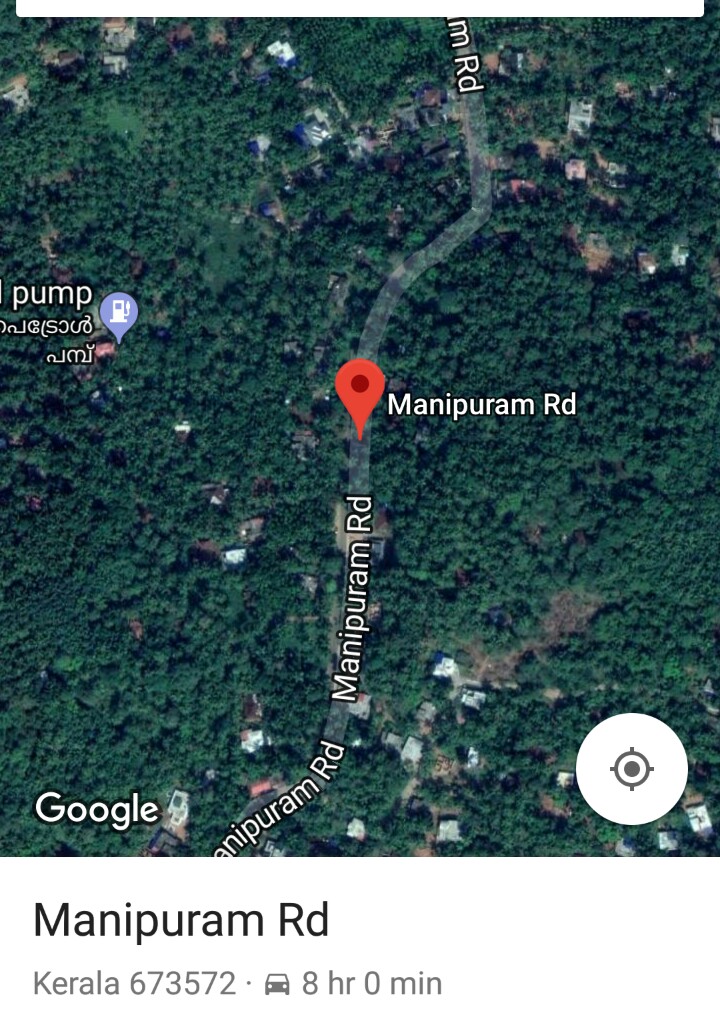
47. Manipuram is in Kozhikode district (Kerala)
48. Manipur is in Raipur district (Chattisgarh)
49. Manipur is in Uttar Bastar Kanker district (Chattisgarh)
50. Manipur is in Surguja district (Chattisgarh)
51. Manipur is in Pithoragarh district (Uttarakhand)
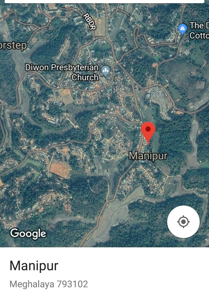
52. Manipur is in Ribhoi district (Meghalaya)
53. Manipur is in Manipur (Kangleipak)


Manipur in Gujarat:
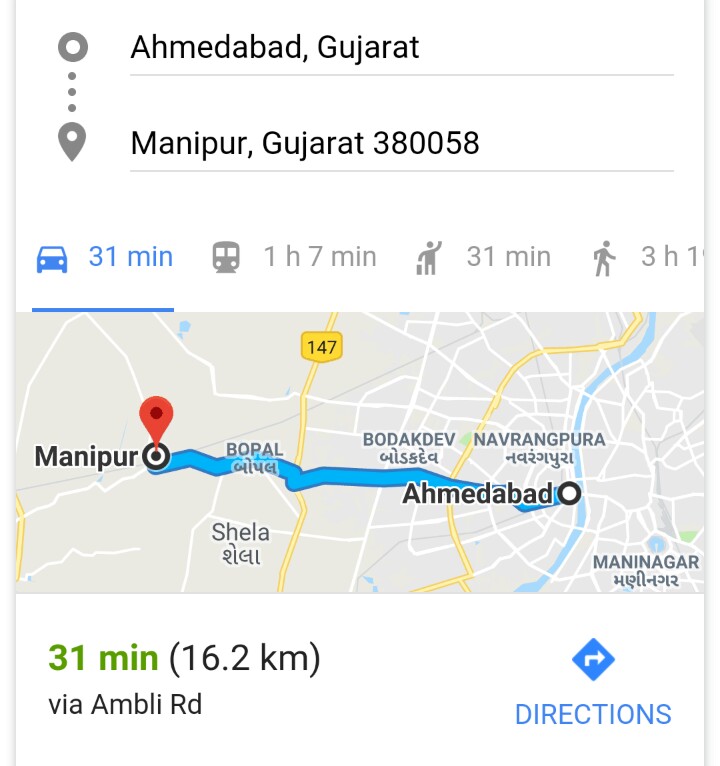
(1) Manipur is a village in Sanand city in Ahmadabad district of Gujarat. Manipur PIN code is 382115 and postal head office is Godhavi. Ghuma, Godhavi, Shela, Garodiya, Bopal are the nearby Localities to Manipur. Sanand, Ahmedabad, Kalol, Gandhinagar are the nearby cities to Sanand. According to Census 2011 information the village code of Manipur village is 511617. The Lok Sabha constituency which Manipur belongs to is Gandhinagar parliamentary constituency. The prominent politician Shri Lal Krishna Advani was/is from this constituency where Manipur belongs to. Manipur in western Ahmedabad is an upcoming real estate hotspot. The locality is surrounded by well-developed areas such as Chekhla, Jodhpur Village, Ambli, Bodakdev, Bopal, Gurukul, Sanand, Satellite, Makarba and Mumatpura.
(2) Manipur is a village in Kadi (Tehsil/Taluk) in Mahesana district of Gujarat. PIN code is 382728 and P.O. is Manipur. Kadi, Kalol, Sanand, Viramgam are the nearby cities to Kadi. According to Census 2011 information the village code of Manipur village is 509698. It is situated 9km away from sub-district headquarter Kadi and 52km away from district headquarter Mahesana. As per 2009 stats, Manipur village is also a gram panchayat. The total geographical area of village is 671.96 hectares.
(3) Manipur is a village in Godhra (Tehsil/Taluk) in Panch Mahals district of Gujarat. Manipur PIN code is 388713 and postal head office is Kakanpur. It comes under Chanchpur Panchayath. It is located 20km towards west from district headquarters Godhra, 114km from state capital Gandhinagar. Manipur is surrounded by Godhra Taluka towards East, Panch Mahals Taluka towards East, Thasra Taluka towards west, Savli Taluka towards South. Godhra, Umreth, Lunawada, Kapadvanj are the nearby cities to Manipur.
Manipur in Rajasthan: Manipur village is located in Dungarpur Tehsil of Dungarpur district in Rajasthan. It is situated 40km away from Dungarpur, which is both district and sub-district headquarter of Manipur village. As per 2009 stats, Rampur Mewara is the gram panchayat of Manipur village. According to Census 2011 information the village code of Manipur village is 097644. The total geographical area of village is 142 hectares. PIN code is 314804.
Manipur in Haryana: Manipur is a village in Chhachaarauli town (taluk) in Yamuna Nagar district of Haryana state. Manipur PIN code is 135103 and post office is Lalheri Kalan. According to Census 2011 information the village code of Manipur village is 058252. It is situated 12km away from sub-district headquarter Chhachhrauli and 30km away from district headquarter Yamunanagar. As per 2009 stats, Manipur village is also a gram panchayat. The total geographical area of village is 105 hectares.
Manipur in Uttar Pradesh:
(1) Manipur is a village in Naraini Tehsil of Banda district in Uttar Pradesh. Manipur PIN code is 210001. Geographical coordinates of Manipur in Uttar Pradesh is 25.3513373 (latitude) and 80.3491529 (longitude). According to Census 2011 information the village code of Manipur village is 155285. It is situated 24km away from sub-district headquarter Naraini and 18km away from district headquarter Banda. As per 2009 stats, Manipur village is also a gram panchayat. The total geographical area of village is 1005.84 hectares.
(2) Manipur village is located in Fatehpur Tehsil of Fatehpur district in Uttar Pradesh. It is situated 13km away from Fatehpur, which is both district & sub-district headquarter of Manipur village. As per 2009 stats, Manipur village is also a gram panchayat. According to Census 2011 information the village code of Manipur village is 156947. The total geographical area of village is 224.31 hectares. PIN code is 212601.
(3) Manipur village is located in Mariahu Tehsil of Jaunpur district in Uttar Pradesh. It is situated 5km away from sub-district headquarter Mariahu and 17km away from district headquarter Jaunpur. As per 2009 stats, Manipur village is also a gram panchayat. According to Census 2011 information the village code of Manipur village is 202469. The total geographical area of village is 86.94 hectares.
(4) Manipur village is located in Handia Tehsil of Allahabad district in Uttar Pradesh. It is situated 45km away from sub-district headquarter Handia and 45km away from district headquarter Allahabad. As per 2009 stats, Manipur is the gram panchayat of Manipur village. PIN code is 212402. According to Census 2011 information the village code of Manipur village is 162864. The total geographical area of village is 225.06 hectares. Allahabad is nearest town to Manipur which is approximately 41km away.
(5) Manipur village is located in Lambhua/ Dhanpatganj Tehsil of Sultanpur district in Uttar Pradesh. It belongs to Faizabad Division. It is situated 18km away from sub-district headquarter Lambhua and 40km away from district headquarter Sultanpur. As per 2009 stats, Manipur village is also a gram panchayat. According to Census 2011 information the village code of Manipur village is 170767. The total geographical area of village is 77.68 hectares. PIN code is 222303.
(6) Mannipur village is located in Gola Tehsil of Gorakhpur district in Uttar Pradesh. It is situated 9km away from sub-district headquarter Gola and 59km away from district headquarter Gorakhpur. As per 2009 stats, Saharauli is the gram panchayat of Mannipur village. According to Census 2011 information the village code of Mannipur village is 187692. The total geographical area of village is 40.73 hectares.
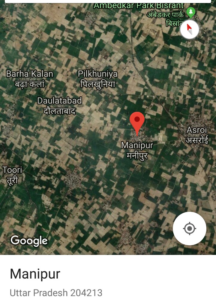
(7) Manipur village is located in Iglas Tehsil of Aligarh district in Uttar Pradesh. According to Census 2011 information the village code of Manipur village is 122903. It is situated 15km away from sub-district headquarter Iglas and 40km away from district headquarter Aligarh. As per 2009 stats, Manipur village is also a gram panchayat. The total geographical area of village is 217.55 hectares. PIN code is 204213.
(8) Manipur village is located in Hardoi Tehsil of Hardoi district in Uttar Pradesh. According to Census 2011 information the village code of Manipur village is 140102. It is situated 35km away from Hardoi, which is both district & sub-district headquarter of Manipur village. The total geographical area of village is 287.11 hectares.
(9) Manipur village is located in Lalganj Tehsil of Pratapgarh district in Uttar Pradesh. According to Census 2011 information the location code or village code of Manipur village is 157858. It is situated 23km away from sub-district headquarter Lalganj and 55km away from district headquarter Pratapgarh. As per 2009 stats, Manuhar is the gram panchayat of Manipur village. The total geographical area of village is 134.2 hectares.
(10) Manipur village is located in Manjhanpur Tehsil of Kaushambi district in Uttar Pradesh. According to Census 2011 information the location code or village code of Manipur village is 160340. It is situated 20km away from sub-district headquarter Manjhanpur and 20km away from district headquarter Kaushambi. As per 2009 stats, Pawara is the gram panchayat of Manipur village. The total geographical area of village is 75.1 hectares.
(11) Manipur village is located in Ballia Tehsil of Ballia district in Uttar Pradesh. According to Census 2011 information the village code of Manipur village is 199381.. It is situated 18km away from Ballia, which is both district & sub-district headquarter of Manipur village. The total geographical area of village is 13.43 hectares.
(12) Manipur village is located in Saidpur Tehsil of Ghazipur district in Uttar Pradesh. According to Census 2011 information the village code of Manipur village is 204299. It is situated 6km away from sub-district headquarter Saidpur and 51km away from district headquarter Ghazipur. As per 2009 stats, Gahmar is the gram panchayat of Manipur village. The total geographical area of village is 78.76 hectares.
Manipur in Bihar:
(1) Manipur village is located in Bandra Tehsil of Muzaffarpur district in Bihar. According to Census 2011 information the village code of Manipur village is 229297. It is situated 3km away from sub-district headquarter Bandra and 39km away from district headquarter Muzaffarpur. As per 2009 stats, Patsara is the gram panchayat of Manipur village. The total geographical area of village is 82.6 hectares. PIN code is 843115.
(2) Manipur village is located in Warisnagar Tehsil of Samastipur district in Bihar. According to Census 2011 information village code of Manipur village is 236323. It is situated 15km away from sub-district headquarter Warisnagar and 3km away from district headquarter Samastipur. As per 2009 stats, Sekhopur is the gram panchayat of Manipur village. The total geographical area of village is 31.16 hectares.
(3) Manipur village is located in Sultanganj Tehsil of Bhagalpur district in Bihar. According to Census 2011 information the village code of Manipur village is 239645. As per 2009 stats, Bhirkhurd is the gram panchayat of Manipur village. The total geographical area of village is 2 hectares.
(4) Manipur village is located in Chausa Tehsil of Buxar district in Bihar. According to Census 2011 information the village code of Manipur village is 248393. As per 2009 stats, Rampurkala is the gram panchayat of Manipur village. The total geographical area of village is 57 hectares.
(5) Manipur village is located in Rajpur Tehsil of Buxar district in Bihar. According to Census 2011 information the village code of Manipur village is 248527. As per 2009 stats, Rajpur is the gram panchayat of Manipur village. The total geographical area of village is 15 hectares.
(6) Manipur village is located in Durgawati Tehsil of Kaimur district in Bihar. According to Census 2011 information the village code of Manipur village is 249539.. It is situated 12km away from sub-district headquarter Durgawati and 34km away from district headquarter Bhabua. As per 2009 stats, Chhaw is the gram panchayat of Manipur village. The total geographical area of village is 30 hectares.
(7) Manipur village is located in Kochas Tehsil of Rohtas district in Bihar. According to Census 2011 information the village code of Manipur village is 250802.. It is situated 9km away from sub-district headquarter Kochas and 33km away from district headquarter Sasaram. As per 2009 stats, Kanjar is the gram panchayat of Manipur village. The total geographical area of village is 34.22 hectares.
(8) Manipur village is located in Dinara Tehsil of Rohtas district in Bihar. According to Census 2011 information the location code or village code of Manipur village is 250856. As per 2009 stats, Bhui is the gram panchayat of Manipur village. The total geographical area of village is 68 hectares.
Manipur in Madhya Pradesh:
(1) Manipur village is located in Ajaigarh Tehsil of Panna district in Madhya Pradesh. It is situated 40km away from sub-district headquarter Ajaigarh and 75km away from district headquarter Panna. As per 2009 stats, Devalpur is the gram panchayat of Manipur village. According to Census 2011 information the village code of Manipur village is 458651. The total geographical area of village is 193.48 hectares. PIN code is 488222.
(2) Manipur village is located in Jawa Tehsil of Rewa district in Madhya Pradesh. It is situated 20km away from sub-district headquarter Jawa and 60km away from district headquarter Rewa. As per 2009 stats, Atraila is the gram panchayat of Manipur village. According to Census 2011 information the village code of Manipur village is 465304. Manipur PIN code is 486447 and postal head office is Patehara. The total geographical area of village is 181.85 hectares.
Manipur in Maharashtra: Manipur village is located in Dahanu Tehsil of Thane district in Maharashtra. It is situated 13km away from sub-district headquarter Dahanu and 103km away from district headquarter Thane. As per 2009 stats, Ganjad is the gram panchayat of Manipur village. According to Census 2011 information the village code of Manipur village is 551670. PIN code is 401602.The total geographical area of village is 781.71 hectares.
Manipur in Orissa:
(1) Manipur is a village in Dhenkanal Sadar (Tehsil/block) in Dhenkanal district of Orissa. It is situated 15km away from sub-district headquarter Dhenkanal Sadar and 15km away from district headquarter Dhenkanal. As per 2009 stats, Manipur village is also a gram panchayat. According to Census 2011 information the village code of Manipur village is 403371. The total geographical area of village is 605 hectares. PIN code is 759027.
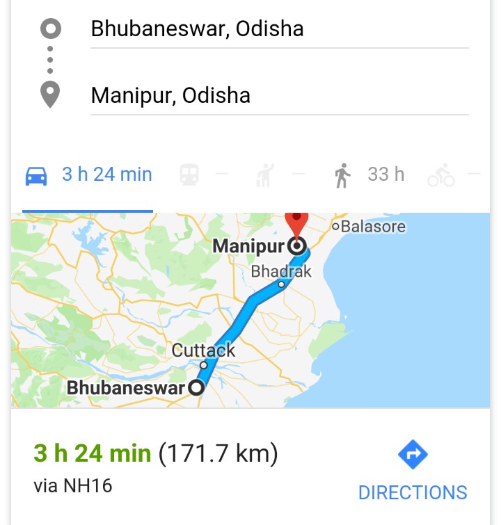
(2) Manipura (of Mahabharat epic) with GPS coordinates: 20°33’48″N 86°22’17″E, is a small village/hamlet in Nikirai/Derabish Tehsil (block) in Kendrapara district of Orissa. PIN code is 754250. The total geographical area of village is 110 hectares. According to Census 2011 information the village code of Manipura village is 396587. It is situated 10km away from sub-district headquarter Nikirai and 10km away from district headquarter Kendrapara . As per 2009 stats, Nahanga is the gram panchayat of Manipura village. It is located 12km towards west from District headquarters Kendrapara, 67km from state capital Bhubaneswar. Manipura is surrounded by Kendrapada Tehsil towards East, Mahanga Tehsil towards west, Garadapur Tehsil towards South, Nischinta Koili Tehsil towards west. Kendrapara, Pattamundai, Jagatsinghapur, Jajapur are the nearby cities to Manipura. This Place is in the border of the Kendrapara district and Cuttack district. Also it is in the Border of other district Jagatsinghapur. Manipura village lies on a river named Gobari. This river flows directly into the sea. This village seems to be part of the Manipura kingdom of Mahabharat and the princess Chitraganda of the Manipura kingdom. The name of this village is the footprint of the ancient territory of Manipura Mahabharat. The place where Gobari river joins the sea viz. Jambu is another candidate for Manipura city where there is a natural harbor.
(3) Manipur is a small village in Soro Tehsil (block) in Baleshwar district of Orissa. Gram Panchayat is Manipur. PIN code is 756047. Geographical Area is 312 hectares. According to Census 2011 information the village code of Manipur village is 393728. It is situated 9km away from sub-district headquarter Soro and 45km away from district headquarter Baleshwar.
(4) Manipur village is located in Pandapara Tehsil of Kendujhar district in Orissa. It is situated 30km away from sub-district headquarter Pandapara and 30km away from district headquarter Kendujhar. As per 2009 stats, Janghira is the gram panchayat of Manipur village. According to Census 2011 information the village code of Manipur village is 386552. The total geographical area of village is 23 hectares. PIN code is 758079.
(5) Manipur village is located in Banapur Tehsil of Khordha district in Orissa. It is situated 3km away from sub-district headquarter Banapur and 70km away from district headquarter Khordha . As per 2009 stats, Bishnudiha is the gram panchayat of Manipur village. According to Census 2011 information the village code of Manipur village is 408486. The total geographical area of village is 25 hectares. PIN code is 752030.
(6) Manipur village is located in Jatani Tehsil of Khordha district in Odisha. According to Census 2011 information the village code of Manipur village is 407832.. It is situated 8km away from sub-district headquarter Jatani and 8km away from district headquarter Khordha . As per 2009 stats, Haripur is the gram panchayat of Manipur village. The total geographical area of village is 84 hectares.
(7) Manipur village is located in Patapur Tehsil of Ganjam district in Odisha. According to Census 2011 information the village code of Manipur village is 412399.. It is situated 8km away from sub-district headquarter Patapur and 63km away from district headquarter Chatrapur. As per 2009 stats, Padamari is the gram panchayat of Manipur village. The total geographical area of village is 88 hectares. PIN code is 761014.
(8) Manipur village is located in Fategarh Tehsil of Nayagarh district in Odisha. According to Census 2011 information the village code of Manipur village is 406123. It is situated 65km away from sub-district headquarter Fategarh and 42km away from district headquarter Nayagarh . As per 2009 stats, Fategarh is the gram panchayat of Manipur village. The total geographical area of village is 447 hectares. PIN code 752063.
(9) Manipur village is located in Panikoili Tehsil of Jajapur district in Odisha. According to Census 2011 information the village code of Manipur village is 400850. It is situated 10km away from sub-district headquarter Panikoili and 24km away from district headquarter Jajapur . As per 2009 stats, Panikoili is the gram panchayat of Manipur village. The total geographical area of village is 87 hectares. PIN code is 755043.
(10) Manipur village is located in Banki Tehsil of Cuttack district in Odisha. According to Census 2011 information the village code of Manipur village is 398917. It is situated 75km away from sub-district headquarter Banki and 80km away from district headquarter Cuttack. As per 2009 stats, Baunsaput is the gram panchayat of Manipur village. The total geographical area of village is 65 hectares. PIN code is 754030.
(11) Manipur village is located in Bansada Tehsil of Bhadrak district in Odisha. According to Census 2011 information the village code of Manipur village is 395463. It is situated 30km away from sub-district headquarter Bansada and 45km away from district headquarter Bhadrak. As per 2009 stats, Totapada is the gram panchayat of Manipur village. The total geographical area of village is 157 hectares. PIN code is 756129.
(12) Manipur village is located in Jharbandha Tehsil of Bargarh district in Odisha. According to Census 2011 information the village code of Manipur village is 379884. It is situated 5km away from sub-district headquarter Jharbandha and 100km away from district headquarter Bargarh. As per 2009 stats, Jharabandh is the gram panchayat of Manipur village. The total geographical area of village is 381 hectares.
(13) Manipur village is located in Puruna Katak Tehsil of Baudh district in Odisha. According to Census 2011 information the village code of Manipur village is 418610.. It is situated 11km away from sub-district headquarter Puruna Katak and 30km away from district headquarter Baudh. As per 2009 stats, Purunakatak is the gram panchayat of Manipur village. The total geographical area of village is 140 hectares. PIN code is 762013.
Manipur in West Bengal:
(1) Manipur village is located in Taldangra Tehsil of Bankura district in West Bengal. It is situated 14.2km away from sub-district headquarter Taldangra. Bankura is the district headquarter of Manipur village. As per 2009 stats, Khalgram is the gram panchayat of Manipur village. According to Census 2011 information the village code of Manipur village is 328602. The total geographical area of village is 165.74 hectares. PIN code is 722121.
(2) Manipur village is located in Raipur Tehsil of Bankura district in West Bengal. It is situated 5.8km away from sub-district headquarter Gar Raipur. Bankura is the district headquarter of Manipur village. As per 2009 stats, Raipur is the gram panchayat of Manipur village. According to Census 2011 information the village code of Manipur village is 329426. The total geographical area of village is 53.65 hectares. PIN code is 722134.
(3) Manipur village is located in Saltora Tehsil of Bankura district in West Bengal. It is situated 13km away from sub-district headquarter Saltora. Bankura is the district headquarter of Manipur village. As per 2009 stats, Pabra is the gram panchayat of Manipur village. According to Census 2011 information the village code of Manipur village is 326082. The total geographical area of village is 61.35 hectares. PIN code is 722133.
(4) Manipur village is located in Onda Tehsil of Bankura district in West Bengal. It is situated 9.9km away from sub-district headquarter Onda. Bankura is the district headquarter of Manipur village. As per 2009 stats, Santore is the gram panchayat of Manipur village. According to Census 2011 information the village code of Manipur village is 328415. The total geographical area of village is 148.18 hectares. PIN code is 722144.
(5) Manipur village is located in Simlapal Tehsil of Bankura district in West Bengal. According to Census 2011 information the village code of Manipur village is 328831. It is situated 2.1km away from sub-district headquarter Simlapal. Bankura is the district headquarter of Manipur village. As per 2009 stats, Bikrampur is the gram panchayat of Manipur village. The total geographical area of village is 162.36 hectares. PIN code is 722151.
(6) Manipur village is located in Jaipur Tehsil of Puruliya district in West Bengal. It is situated 8.4km away from sub-district headquarter Jaipur and 33.2km away from district headquarter Purulia. As per 2009 stats, Upankahan is the gram panchayat of Manipur village. According to Census 2011 information the village code of Manipur village is 329866. The total geographical area of village is 146.32 hectares. PIN code is 723201.
(7) Manipur village is located in Purulia Ii Tehsil of Puruliya district in West Bengal. According to Census 2011 information the village code of Manipur village is 329908. It is situated 10.4km away from Purulia, which is both district & sub-district headquarter of Manipur village. As per 2009 stats, Ghonga is the gram panchayat of Manipur village. The total geographical area of village is 81.34 hectares. PIN code is 723149.
(8) Manipur village is located in Para Tehsil of Puruliya district in West Bengal. According to Census 2011 information the village code of Manipur village is 330022. It is situated 17.7km away from sub-district headquarter Para and 33.2km away from district headquarter Purulia. As per 2009 stats, Bahara is the gram panchayat of Manipur village. The total geographical area of village is 110.74 hectares. PIN code is 723126.
(9) Manipur village is located in Raghunathpur Ii Tehsil of Puruliya district in West Bengal. According to Census 2011 information the village code of Manipur village is 330246. It is situated 11.2km away from sub-district headquarter Raghunathpur and 69km away from district headquarter Purulia. As per 2009 stats, Nildih is the gram panchayat of Manipur village. The total geographical area of village is 70.29 hectares. PIN code is 723133.
(10) Manipur village is located in Polba Dadpur Tehsil of Hugli district in West Bengal. It is situated 5.1km away from sub-district headquarter Polba and 32km away from district headquarter Chinsura. As per 2009 stats, Akhna is the gram panchayat of Manipur village. According to Census 2011 information the village code of Manipur village is 325150. The total geographical area of village is 54.78 hectares.
(11) Manipur village is located in Dhaniakhali Tehsil of Hugli district in West Bengal.According to Census 2011 information the village code of Manipur village is 324676. It is situated 12.2km away from sub-district headquarter Dhaniakhali and 33.8km away from district headquarter Chinsura. As per 2009 stats, Khajudahamilki is the gram panchayat of Manipur village. The total geographical area of village is 95.38 hectares. PIN code is 712303.
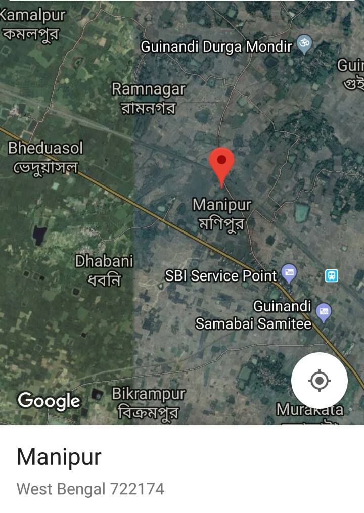
(12) Manipur village is located in Sandeshkhali Ii Tehsil of North Twenty Four Parganas district in West Bengal. It is situated 15.2km away from sub-district headquarter Kumarjola. Barasat is the district headquarter of Manipur village. As per 2009 stats, Manipur village is also a gram panchayat. According to Census 2011 information the village code of Manipur village is 323901. The total geographical area of village is 1083.3 hectares. PIN code is 743446.
(13) Manipur village is located in Balurghat Tehsil of Dakshin Dinajpur district in West Bengal. According to Census 2011 information the village code of Manipur village is 311301.. It is situated 11.9km away from Balurghat, which is both district & sub-district headquarter of Manipur village. As per 2009 stats, Gopalbati is the gram panchayat of Manipur village. The total geographical area of village is 45.4 hectares. PIN code is 733103.
(14) Manipur village is located in Tapan Tehsil of Dakshin Dinajpur district in West Bengal. According to Census 2011 information the village code of Manipur village is 311644. It is situated 22.1km away from sub-district headquarter Tapan. Balurghat is the district headquarter of Manipur village. As per 2009 stats, Gophanagar is the gram panchayat of Manipur village. The total geographical area of village is 120.43 hectares. PIN code is 733102.
Manipur in Assam:
(1) Manipur No. 1 village is located in Marigaon Tehsil of Morigaon district in Assam. It is situated 5km away from sub-district headquarter Marigaon and 5km away from district headquarter Morigaon. As per 2009 stats, Manipur is the gram panchayat of Manipur No. 1 village. According to Census 2011 information the village code of Manipur No. 1 village is 283890. The total geographical area of village is 159.96 hectares. PIN code is 782105.
(2) Manipur No. 2 village is located in Marigaon Tehsil of Morigaon district in Assam. It is situated 4km away from sub-district headquarter Marigaon and 4km away from district headquarter Morigaon. As per 2009 stats, Manipur is the gram panchayat of Manipur No. 2 village. According to Census 2011 information the village code of Manipur No. 2 village is 283891. The total geographical area of village is 124.58 hectares. PIN code is 782105.
(3) Bar Manipur village is located in Marigaon Tehsil of Morigaon district in Assam. According to Census 2011 information the village code of Bar Manipur village is 283889. It is situated 6km away from sub-district headquarter Marigaon and 6km away from district headquarter Morigaon. As per 2009 stats, Manipur is the gram panchayat of Bar Manipur village. The total geographical area of village is 127.83 hectares.
(4) Manipur village is located in Barnagar Tehsil of Barpeta district in Assam. According to Census 2011 information the location code or village code of Manipur village is 282624. It is situated 22km away from district headquarter Barnagar. Barnagar is the sub-district headquarter of Manipur village. As per 2009 stats, Khairabari is the gram panchayat of Manipur village. The total geographical area of village is 98.03 hectares. PIN code is 781315.
Manipura in Karnataka: Manipura village is located in Udupi Tehsil of Udupi district in Karnataka, India. Udupi is nearest town to Manipura village. According to Census 2011 information the village code of Manipura village is 608853 with 13.28115 latitude and 74.7633 longitude. Manipura PIN code is 576120 and postal head office is Moodubelle. Kemthoor, Kurkalu, Alevoor, Katapadi, Katapady are the nearby localities to Manipura. Udupi, Kota, Karkala, Mudbidri are the nearby cities to Udupi.
Manipuram in Kerala: Manipuram, with 11.67 latitude and 75.61445 longitude, is a small Village/hamlet in Koduvally Block in Kozhikode district of Kerala. It comes under Koduvally Panchayath. It belongs to North Kerala division. It is located 20km towards East from District headquarters Kozhikode, 3km from Koduvally, 395km from state capital Thiruvananthapuram. Manipuram Pincode is 673572 and postal head office is Kotuvalli.
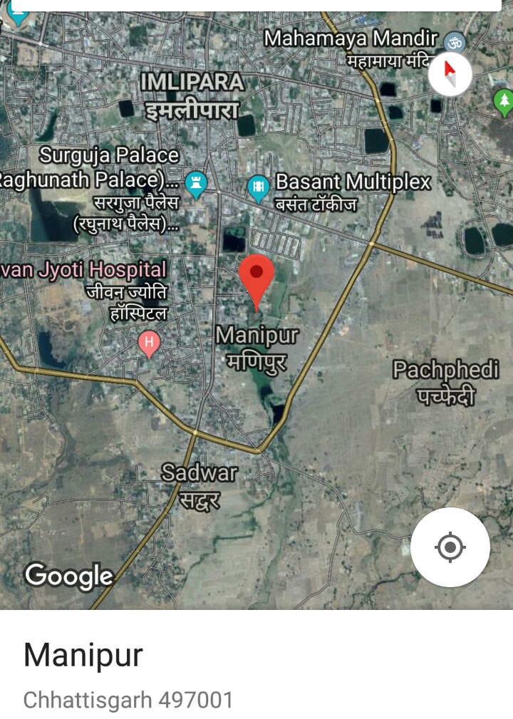
Manipur in Chattisgarh:
(1) Manipur is a small village/hamlet in Baloda Bazar/Gariyaband Tehsil in Raipur district of Chattisgarh. It comes under Sarkhor Panchayath. The geographical coordinates of Manipur is 21.196776 latitude and 81.611724 longitude. It is located 91km towards East from district headquarters Raipur, 91km from state capital Raipur. Manipur PIN code is 493526 and postal head office is Lawan. Manipur is surrounded by Palari Tehsil towards South, Bhatapara Tehsil towards west, Kasdol Tehsil towards East, Pamgarh Tehsil towards East. Baloda Bazar, Bhatapara, Akaltara , Bilaspur are the nearby cities to Manipur.
(2) Manipur village is located in Pakhanjur Tehsil of Uttar Bastar Kanker district in Chhattisgarh. According to Census 2011 information the village code of Manipur village is 448373. It is situated 44km away from sub-district headquarter Pakhanjur and 170km away from district headquarter Kanker. As per 2009 stats, Vikaspalli is the gram panchayat of Manipur village. The total geographical area of village is 112.3 hectares.
(3) Manipur is a small village/hamlet in Ambikapur Tehsil in Surguja district of Chattisgarh State. PIN code is 497001 and post office is Ambikapur.
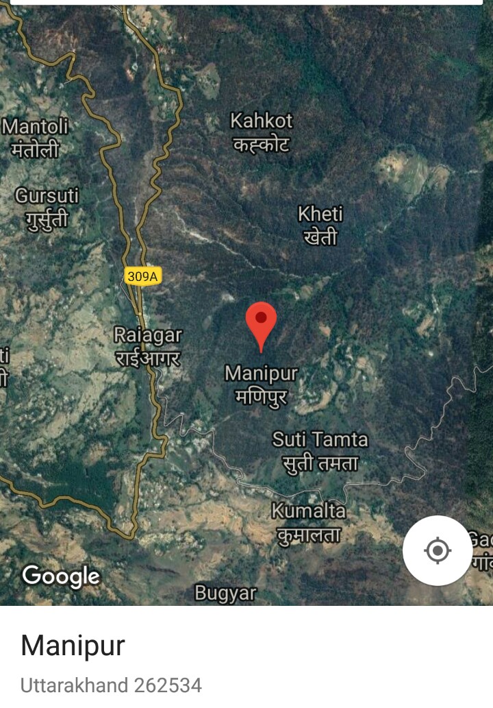
Manipur in Uttarakhand: Manipur village is located in Berinag Tehsil of Pithoragarh district in Uttarakhand. According to Census 2011 information the location code or village code of Manipur village is 049764. It is situated 8km away from sub-district headquarter Berinag and 94km away from district headquarter Pithoragarh. As per 2009 stats, Maanipur is the gram panchayat of Manipur village. The total geographical area of village is 14.08 hectares. PIN code is 262534.
Manipur in Meghalaya: Manipur village is located in Umling Tehsil of Ribhoi district in Meghalaya. According to Census 2011 information the village code of Manipur village is 277554. It is situated 43km away from sub-district headquarter Umling and 21km away from district headquarter Nongpoh. Umling is nearest town to Manipur. PIN code is 793102.
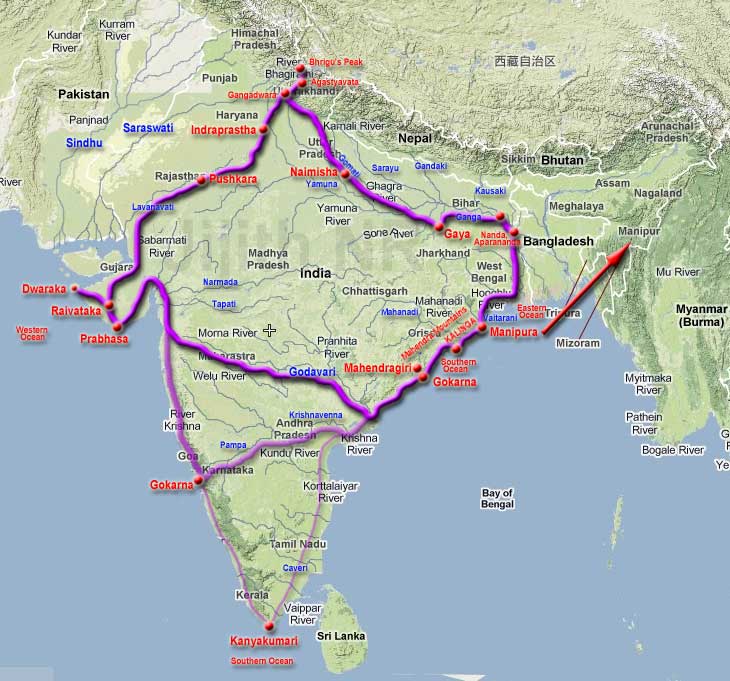
Manipur in Manipur (Kangleipak)
Manipur is a State located in North Eastern part of country India. The geographical coordinates of Manipur state is 24.6637° N (latitude), 93.9063° E (longitude). The total area covered by Manipur is 22,347 square kilometers. Manipur shares its borders with Nagaland, Mizoram, and Assam. The state shares its international borders with Myanmar.
Historically, the erstwhile country Kangleipak became Manipur in the first half of 18th century AD. And the then Manipur Country became Manipur State of country India on 15th Oct, 1949. Soon after the burning of all Puyas, the changing of the name from Kangleipak to Manipur had happened during the reign of King Pamheiba, who was born as illicit child to a Thakur cum culprit Bishnu Goswami and Sapam Chanu Nungthil Chaibi (daughter of Chothe Khullakpa), as parents. The proposal of changing the name of the country came from another Thakur cum perpetrator Shanti Das Goswami (Gosai), who came to Kangleipak from Sylhet (then West Bengal, now in Bangladesh) through Silchar/Cachar. Not only changing the name of Kangleipak to Manipur, King Pamheiba changed the name of the place (district) Lamangthong to Bishnupur in honour of his father Bishnu Goswami. Thus, the name of the land Kangleipak, which is the birth place of the Meetei Race, which was given by our brave ancestors many centuries before Christ (BC) has been changed to Manipur by king Pamheiba under the persuasion of vagabond Thakur Shanti Das Goswai in the first half of 18th century AD (in around 1735 AD).
Thus, the following points can be drawn from above facts:
1. There are 67 (sixty seven) Manipurs found in country India. West Bangal (home place of Shanta Das Gosai) has highest number of Manipurs (14 nos.), Orissa has 13 Manipurs, Uttar Pradesh has 12 Manipurs, Bihar has 8 Manipurs, Assam has 4 Manipurs, Gujarat has 3 Manipurs, Chattisgarh has 3 Manipurs, Madhya Pradesh has 2 Manipurs, and Rajasthan, Haryana, Uttarkhand, Karnataka, Kerala, Meghalaya, Maharastra has 1 Manipur each. The name Manipur is found in almost all the states of India. Manipur is predominantly found in mainland India than the North Eastern part of India.
2. All the 66 (sixty six) Manipurs except the Manipur state are villages/hamlets. None of the 66 Manipurs has the status of even a District. The suffix “pur” is applicable only for small areas like villages/cities/hamlets, but not for State. There is no state found in India with the suffix “pur” except the converted name Manipur state.
3. Manipur(a) of Mahabharat epic is in Kendrapara district of Orissa. The route map of Arjun’s pilgrimage does not cover Manipur state and there is no connection of Arjun and Manipur state. Chitrangada, the princess of Manipura kingdom was from Kendrapara district of Orissa, but not from present Manipur state which was called Kangleipak originally. There is no name Kangleipak found in Mahabharat epic.
4. The changing of the erstwhile country name Kangleipak to Manipur has happened in the 1st half of 18th century AD by King Pamheiha under pursuance of a Thakur cum perpetrator called Shanti Das Goswami.
5. The name Manipur appears to be antagonistic to the people of Kangleipak. By changing the name Kangleipak to Manipur, Shanti Das Goswami created two controversies – (A) the status of a country Kangleipak was downgraded/lost to the status of a village as the name Manipur is found only as village (66 villages in the name of Manipur), (B) Kangleipak was projected as Manipur(a) of Mahabharat epic and tried to bring several artifacts like Meetei race is/as descendents of Arjun.
6. The diplomatically given name Manipur state shall be reverted back to Kangleipak to resolve the controversies created by Shanta Das Goswami. Until the name is changed, the name Manipur has no meaning. Please write “Manipur State” instead of Manipur. Also, Bishnupur which was given by king Pamheiba in honour of his father Bishnu Goswami shall be changed back to Lamangthong.
7. Finally, the question “where is Manipur…?” is invalid unless specified “which Manipur…?” and “I’m from Manipur” has no meaning…!!!


Thanks for the wonderful piece Mr.Ningthoujam. Hope the Govt of Manipur State and CSOs read your article and do the needful to rectify the altered history and culture of Kangleipak.
Very nice article and inspiring too. Kindly check the one mentioned in allahabad district. It should be Manikpur but not manipur.
Thagatchari eyamba Raghu Ningthoujambu mamal yamlaba article asigidamak makha tana miyamgi seba touba ngamba oibiyu.
Very good article, its realy an eye opener documentation. I hope this article will help to our younger generations. Hope Mr Raghu will upload another episode….
I have gone through the article written by Raghu Ningthoujam of ISRO. If we help his article to circulate through length and breadth of the state, it would convey a very clear message to those who want to keep in juxtaposition of our Kangleipak to the episode of Mahabharata. Thanks to Raghu for his splendid work.
Nice documentation and an eye opener too. Government of Manipur State can always change the State’s name to “Kangleipak” which is the original meitei name of Manipur. Its my personal opinion. Once upon a time Tamilnadu was called Madras. But it was subsequently changed to Tamilnadu. Even name of some cities have been changed to indeginous name. For example Madras to Chennai, Calcutta to Kolkata, Bombay to Mumbai…May be some registered institution cannot be changed. Like Calcutta University. It is not changed to Kolkata University. Similarly IIT, Madras. I think it is not IIT, Chennai. Good to see ” Kangleipak” in future…
Nice documentation and an eye opener too. Government of Manipur State can always change the State’s name to “Kangleipak” which is the original meitei name of Manipur. Its my personal opinion. Once upon a time Tamilnadu was called Madras. But it was subsequently changed to Tamilnadu. Even name of some cities have been changed to indeginous name. For example Madras to Chennai, Calcutta to Kolkata, Bombay to Mumbai…May be some registered institution cannot be changed. Like Calcutta University. It is not changed to Kolkata University. Similarly IIT, Madras. I think it is not IIT, Chennai. Good to see ” Kangleipak” in future.
Nice documentation and an eye opener too. Government of Manipur State can always change the State’s name to “Kangleipak” which is the original meitei name of Manipur. Its my personal opinion. Once upon a time Tamilnadu was called Madras. But it was subsequently changed to Tamilnadu. Even name of some cities have been changed to indeginous name. For example Madras to Chennai, Calcutta to Kolkata, Bombay to Mumbai…May be some registered institution cannot be changed. Like Calcutta University. It is not changed to Kolkata University. Similarly IIT, Madras. I think it is not IIT, Chennai. Good to see ” Kangleipak” in future
Excellent Raghu for a research and commendable – R.Ganesh KI, Bangalore.
This article is profoundly marvellous and an eye opener to many new facts that were not known earlier.Undoubtedly lot of sincere efforts has been made to bring out the true story based on exhaustive studies of history,ancient civilisations and mythology. The article is really exemplary n worth reading for a true understanding of the origins and beginning of manipuri descendants.
This excellent article has raised the curiosity (by title itself !) of people, are eager to know and understand fully about Manipur in depth. Reading this article is very inspiring and makes our mind replete with lots of new information and imparts knowledge that was hitherto unknown. This article is exhilarating and very realistic in nature. It is subjective and imperative to the people of Manipur state. Kudos to Raghu Ningthoujam.
Thagatchare yambung RAGHU . unbelievable surprised article adomge research haifam khangdana thagatchare
Ningthoujam bro ! Nahakki research pu ngamkhei leitana thagatchari . Tungdasu thagatlakpa ngamba oibiyu. I m proud of u. God bless u always.
Thanks , eyamba Raghu Ningthembam,
Beings a people of many things are not very clear since birth , this is one of the best articles so , for related to current issues which the google even fail to explained , kept sharing the articles in time beings 👍👍👍👍👍👍
So sorry , eyamba Raghu Ningthoujam , haigadabni autoword chatkhare , ngakpigani
Much appreciated. Never knew this.
The most awaited change which will make our indigenous identity and existence valid on this planet.
Thagtchari Raghu Ningthoujam.
In spite of his tight scientific thickings and complex research assignments at ISRO, he has also time for such a research based neatly prepared write-up. ThankS Raghu. I appreciate and proud of you.
Thoroughly research write up by ISRO scientist Raghu Ningthoujam. This is one of the most interesting article i have come across and very relevant particularly for Meitei younger generations and for the general people of Manipur state. Thank you Raghu Ningthoujam.